Kayıtlar

2021 tarihine ait yayınlar gösteriliyor

About dimension reached of Magnetometer data based on Stackplot data

You know about some stackplot data structures on Worldscale(For example,Stackplot(Eu),Stackplot(North America)).I especially interest to cond reached to amateur dimensions on a reference of actual times of these type plots.For informations about chapter; https://www.mist.ac.uk/nuggets/117-measuring-a-geomagnetic-storm-with-a-raspberry-pi-magnetometer

12/31_Analysis Conclusions,important location determinations for some geoenvironments on critic geometric relations(I especially emphasize significance of green pins and intersections)

Resim
 

I open to file caused a confusion for various people

Resim
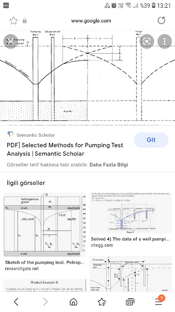
I frequently face to questions of some geoenvironments about how progressed for a landpart on hydraulic principles of groundwater.I must say that they are very very right for this questions.Because,subject "big confusion cond"   on this chapter.Generally,my reference point for chapter is section of hydraulic gradient handled during pumping tests; Yes,hydraulic gradient information of section is a 'mind opener'  for  solution of  chapter(informations about mean of hydraulic gradient maps of various person are very low quality.You are right!I sign to weird a infogap for descriptions as hydraulic dev of this type  gradient distribution maps.Thus,You have  a mind clearer for means considering gradient contours of this hydraulic gradient information handled during  pump test👍) Also,I know to problem for "focus headline" of various geoenvironment about chapter based on Geophysics application😌At this point,I will suggest focusing to puclications about GROUNDWATER

12/30_Analysis Conclusions,important location determinations for some geoenvironments on critic geometric relations(I especially emphasize significance of green pins and intersections)

Resim
 

REPORT_Dec 29,2021

Lignite reserves present distinctive characteristic/s based on different specifications...Characteristic as Geophysics for Gölyaka Openpit Reservoir is related to Trap Stru.!    On a experiment of individual land observation studies handled,Gölyaka main lignite zone is summarying "very selective a cond" as Geophysics with trap stru. presented of  upper deformation zone.On this perspective,we sign to data established of high resolution seismic reflection technique among joker geophysics applications with chapters as expansion projects of basin.On this data,expressing precious informations to decision makers related to reserve stru. geometry of basin considering correlation chapters via a reference of nice stratigraphy informations of trap zone of actual openpit location. UPDATE 7/1: A short video about chapter; https://m.youtube.com/watch?v=JhGTiVpvBGQ   

Selective Atmospheric Phenomena

Resim
 

12/29_Analysis Conclusions,important location determinations for some geoenvironments on critic geometric relations(I especially emphasize significance of green pins and intersections)

Resim