Kayıtlar

Ocak, 2019 tarihine ait yayınlar gösteriliyor

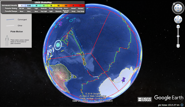
reflection model on centre by 10000km approach that producing to very powerful conclusions

Resim
      interesting conclusions via considering to reflection model on centre by 10000km approach are establishing...For example ,Sicily region with Google Earth 180 degree functionality for r radius via applying to 10000 determination by Rhodos region seismic event that presenting to implication                   https://www.volcanodiscovery.com/etna/news/74186/Etna-Volcano-Volcanic-Ash-Advisory-EXPLOSIVE-ACTIVITY-IS-INCREASED-OBS-VA-DTG-260900Z.html       Modelling studies of Core Activity on Latest Solar Events have densed...All conditions as orthogonal for globe as 3d of expressed model can express;         Note:Circle radius determination that determined on Etna Volcano.As conclusion; Circle boundaries that corelated on latest seismic events and especially volcanisms* !!! And,Cross Centres are as important tectonic locations * Some interestinc volcanims: Stromboli,Soufriere Guadolupe          

A "destructive region" expression about Akhisar region of Turkey have confirmed

Resim
A "destructive region" expression about Akhisar region of Turkey have confirmed; Analysis of a 10000km Radius shows that for Showa Guyot region; a 10000km analysis on Location yields that for Gilan Region; And,final 10000 analysis confirms that as triple junction; other analysis for Akhisar Destructive Location that as transform structure evaluations with 6000km explosive centres; Mayotte Irkutsk-Buryatia Boundary Region Third explosive location;         By analysis conclusion as Transform Structure; Lake Tanganyika Region Lake Baikal Region  are expressing.

Analysis of explosive locations on Chatham Pyramidal Structure

Resim
Via considering to Pyramid Structure of Chatham Islands Region I evaluated that as a destructive centre.Thus,A analysis have realised;   Where,my reference is Manam Explosive Island.Other ~explosive location descriptions;    

common Geophysical Concept Model about Geologic Development Structure of Coastal Regions

Resim
A common Geophysical Concept Model about Geologic Development Structure of Coastal Regions have prepared; Where,role for structure development of inner forces via considering to Geologic timeframe is especially underlining.Also, for explaining to some island type structures for chapters on geologic risk potential of Coastal Hinterland Regions very clear informations are establishing... 

A methodology of establishing to Transform type locations with Google Earth

Resim
How understanding to transform a type location on a explosive volcano information? Manam Volcano that a important island volcano of Pupua-New Guinea Region.This volcano is not eruptive.Explosive style a volcano!!!expressing as collision boundary of Australia plate with Pasific plate at Bismarc Sea Region...Latest important development is as last Aug(2018). A 10000km radius analysis on this location shows that famous Mendonico Fault.Next,Considering to analysis on circle line of second explosive style volcano  via 6000km triangulation method.Thus,catching to transform type strcuture by this line analysis(experience)!!! Manam Volcano coordinate;     Analysis on 10000km(White circle) from this point express that as clear is not a explosive volcanism.Thus,confirmation methodology  to established location on experiments for a underwater volcanism thus,will be complementary       Yellow line express that Kamchatka as a 10000kmradius.So,a famous swarm location;  

location descriptions on Bezymianny analysis

Resim
location descriptions  on Bezymianny analysis; Bezymianny shows that redcircle on 10000km distance   Evaluating(~Kermadec line) as Explosive location by Redcircle analysis;   Next,a 10000km Radius(iceblue circle) from this point;       drawing as 45 degree and 6000km line  of Corner points;       Conclusions(Zooming);   

Analysis of third explosive location on Kavachi

Resim
Analysis of third explosive location on Kavachi information. A 10000km Radius from Kavachi have analysed;   Where,I evaluated Isla de Pascua(Easter Island);         Thus,10000line have carried-out;        10000 radius from Isla de Pascua(greenline);     45degree and 6000km lines;     And,third explosive location;         location description         ~Mt.Itsi Region        

Datça Region and Mt.Shindake_third Explosive Region Analysis

Resim
https://plus.google.com/u/0/109215510128907332215/posts/eeGZs9aKwaW Where,approach shorty that on information, a 10000km with offshore region of Mt.Shindake as high elevated by a explosive structure information for Datça region... So,such a structure for Datça with a explosive underwater structure on line of Mt.Shindake is understanding;     Next,a 10000 Radius from Mt.Shindake(red circle);         A 6000 Radius from Datça Explosive;       two posibilities-on destructive location centres.For this,two 6000radius that considering;       Next,line on centre for posibility one-yellow;       a 6000 radius on centre for possibility one-green;       intersection of red and greeen curves that second line(brown)-other alternative with angle on first line;   third yellow line; finding on angle to third point from two explosive point for second possibility(three white line); And,conclusions posibility2

What is Datça Event? and some discoveries

Resim
What is Datça Event? Because,some uncertainties for Region is subject.Firstly,I will consider on this issue; For this aim,a 10000km Radius that firstly analysed; Thus,Agung Volcano with experiments have understood; ;       Next,10000km Radius have established(yellow arc);       Analysis on Yellow arc show that Hawaii which a Swarm location;         With this location,a 10000km analysis that establishing to triplejunction as conclusion;       Note: Datça Event with Marker expressions that fixing as 'a important Earthquake Produced Location'     Next,this time,I considered that for "a destructive centre" condition.Thus,a 6000km Radius(purple circle)from this centre have analysed;          Caboverde on Purple circle is characteristic;              And,other orange lines on knowed angles;       For target locations of lines;   Caboverde   Popigai  Se