Orfeus as European Infrastructure for Seismic Waveform in European Observating System on AlpArray Initiative is knowing on Seismologic Infrastructure Studies into European Hinterland. New vision that shortly,expressing as "Synergy" With this aim,widening of organisational structure is basepoint.For this,emphasizing to powerfulness of a "mass approach" on observing of European Hinterland on opensource programming language As a conclusion of efforts in this field,a "Data Network Structure System" on Obspy&Python Programming Capabilities have developed. Shortly,reading on internet network of basedata &carrying-out by user of some data process steps.And next,presenting on some types of some conclusions... So,summarying as "Platform Structure" On earthquake researches,providing to international a "synergy" on ground researches besides earthquake via user networks at hinterland countries for establishing as powerful of inf...


By the way,I established a condition check on some dbase publishes about Impact Craters...Class-2 "Duolun Structure" confirmed me.Technic informations about structure:
YanıtlaSilCountry: China (Asia)
Diameter: 70-190 km
Position: 42.05, 116.25
Age: 129 ± 2 Million Years
Drilled?:
Exposed?:
Description: Several abstracts describe a multiring impact structure ~200 km north of Beijing, China. These papers recognize inner structural ring 70 km in diameter marking occurrences of various breccias, middle ring 120 km in diameter and an outer ring 190 km in diameter. A range of various impact breccias and megabreccias, suevites, impact melt sheets with mineral fragments and microlites, aerodynamically shaped melt bombs with schlieren and fluidized ejecta have been reported but almost no data were presented to support these claims (Siben, 1987; Siben and Shuyuan, 1987; Wu and Zhang, 1987; Siben, 1989; Wu, 1989; Wu, 1990; Wu and Zhang, 1992). The target consists of granodiorite, shale siltstone, sandstone, limestone, and andesite; the andesites are of the Upper Jurasic age. Coal deposits found via drilling in the western peripheral trough (>600 m deep) is lower Cretaceous. K-Ar age of the interpreted impact melt is 129 ± 2 Ma (Siben, 1987). All data in the database are taken from (Siben, 1987). The significance of the K/Ar age is uncertain considering the lack of data on the structure. Also, if the melt sample is indeed from impact and contains fragments of minerals the K-Ar is almost certainly inaccurate. The uncertainty range listed in the database is therefore taken from the stratigraphic constraints (D. Rajmon). The base Upper Jurassic and top lower Cretaceous are calibrated with Gradstein et al. (2004).
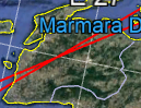
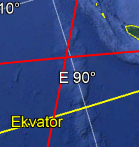
Subject a M5.6 event(Fiji region) among tectonic region alerts during controls(expressed as triangle frame).
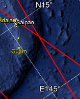
YanıtlaSilIn the other hand,I observed some events for NZ trench region between M4.0-M5.0 environment among descripted tectonic regions
YanıtlaSil