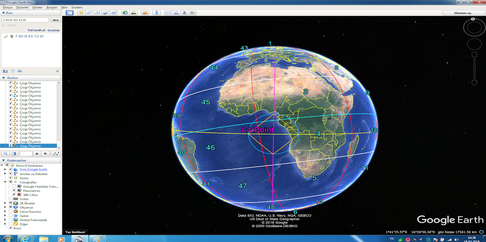
Google Earth_Understanding to Earth
M5.1 event have presented;
https://plus.google.com/u/0/photos/109215510128907332215/album/6523226081047331489/6523226084814754210?authkey=CPvL6LKH8PGnew
Thus,I calculated on M5.1 event and near Volcano criteria that other some informations with Increasing and Decreasing Circles


--------------------------------------------------------------------------------------------------------------------------
M5.0 event have presented
https://plus.google.com/u/0/photos/109215510128907332215/album/6523226081047331489/6523226085240709362?authkey=CPvL6LKH8PGnew
Lifting and Subsiding Circles and other some informations


-------------------------------------------------------------------------------------------------------------------------
M4.2 event have presented
Lifting and Subsiding Circles and other some informations


--------------------------------------------------------------------------------------------------------------------------
M4.5 event have presented
Lifting and Subsiding Circles and other some informations


-------------------------------------------------------------------------------------------------------------------------
M5.3 event have presented
Lifting and Subsiding Circles and other some informations


-------------------------------------------------------------------------------------------------------------------------
I informed about March 25,2018 Nigeria Landslide event;


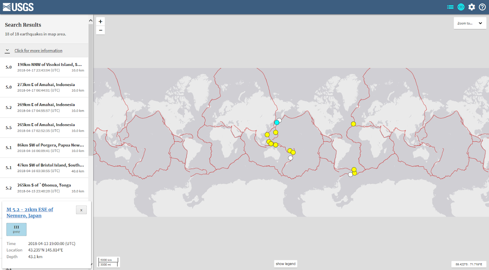
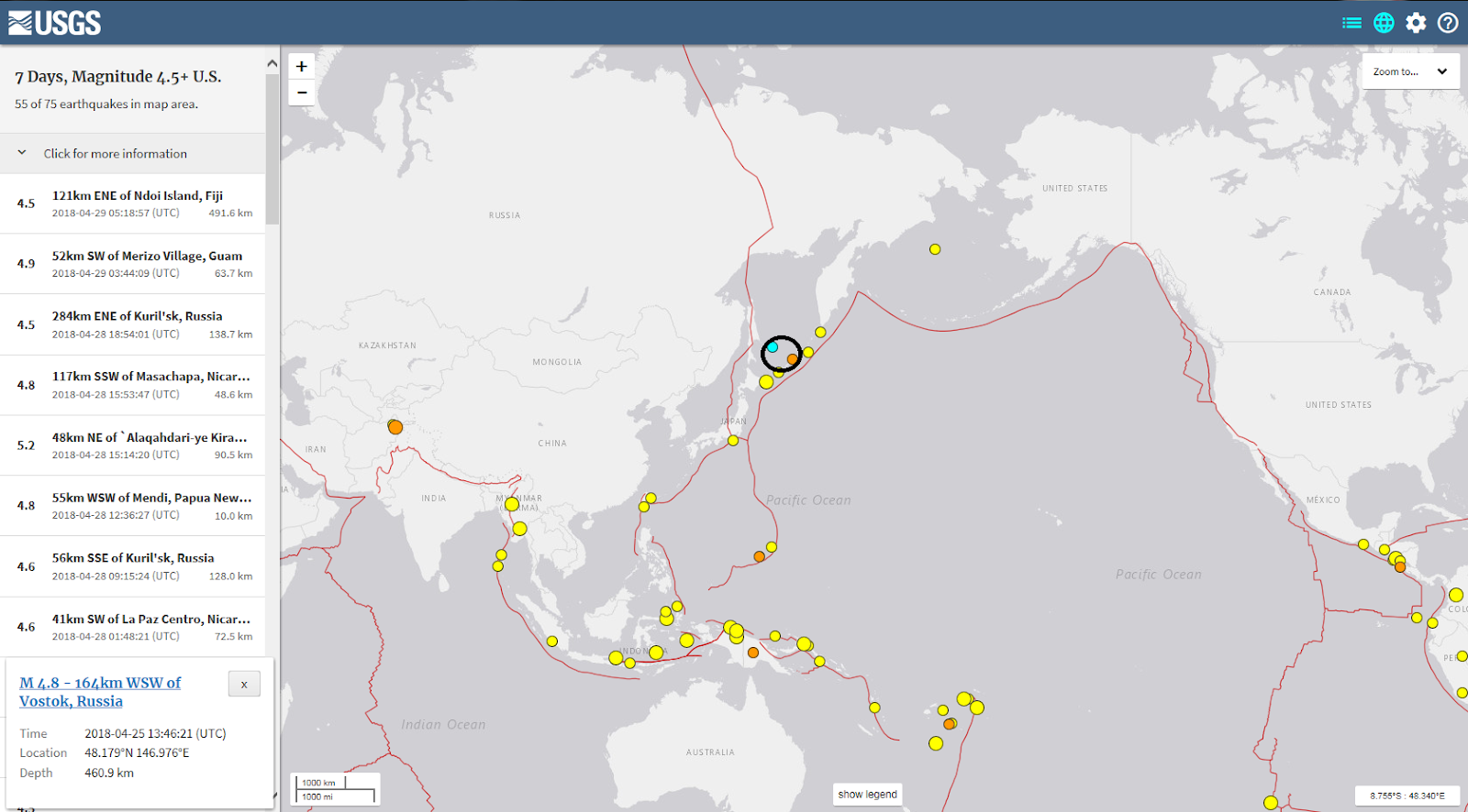
I realised a working on this direction...USGS Earthquake Data;

M 6.3 event that ~10000 km as distance.Thus,My analysis conclusions;


Next,I informed about flood event;


Thus,you see detailed L2 point circumference among above snapshoots.Shortly,such flood event into evaluated a field as our will depress as evaluated is realising...
Good Days
--------------------------------------------------------------------------------------------------------------------------
Hello everybody.I informed that

And,as map presentation of province;

Thus,identifying on route of established thick red line to L3 and L4 on M6.3 event of Shemonaikha flood event thus,presenting to other a perspective for understanding to L3 and L4 circle

--------------------------------------------------------------------------------------------------------------------------M6.6 event have presented
Lifting and Subsiding Circles and other some informations


--------------------------------------------------------------------------------------------------------------------------
I shared this information;
Thus,I realised a literature study.And,

M4.8 event that established for this study.Conclusions;


I express that a "Landslide and Flooding prone zone" for this line as a conclusion of examples as Corsica-Paris-London on Red line
-------------------------------------------------------------------------------------------------------------------------
29.3.2018 M6.9 Papua-New Guinea Event that a Electrical Earthquake.So,CME effected to core as direct.You know that I shared to alpha=180 approach for this condition.Thus,I realised some studies;


So,There is a earthquake as big possible along this boundary for green circle.And conclusion;
presenting as Azores Region
--------------------------------------------------------------------------------------------------------------------------
for trigger source as conclusion of a analysis for event;

A analysis on M4.7 Earthquake;
(Note:Darkblue line for Landslide and Flooding prone fields especially presented)


-------------------------------------------------------------------------------------------------------------------------
I shared to this information for Cleveland Volcano
I would like to mathematical a suggest as a supply to studies with inverse approach.
Before,I think as secondary a conclusion of effects to Earth Core of CME for this type volcanic events.(You know that my 180 degree solution as angle!)
Thus,Green circle via invers approach is presenting.(Distance as (pi*r) from Cleveland Volcano);

2 events on USGS data are identifying;


Angle between Event1 and Event2 on Green circle apprx. 130 degree.So,If Event 1 knowing,second circle on Event 2 thus is drawing;

------------------------------------------------------------------------------------------------------------------------


And 10000 line conclusions;

Aral Lake Province especially interesting


----------------------------------------------------------------------------------------------------------------------
You know that I shared a Rockslide Event at Spain
Thus,I realised some studies...
And thus,conclusions are presenting


detailed radial conlusions based on points;


I especially say that on white line,similar effects are on this line;


Especially,
Sicily and Sardegna Coasts
Coasts of New Scotland Island
Coastal Province of Seychelles
South Province of Red Sea
interesting...
------------------------------------------------------------------------------------------------------------------------
I have shared this Landslide Information;
I evaluate latest Important Earthquake Informations by USGS that Yellowline quite powerful a implication based on Sea of Laptev!!!And,Thus,I realised a job as quite effective
Also,Circle Zones
are presenting...
You evaluate that
-Kampala-Karakas
-Akra
-Yamoussoukro
-Port of Spain
quite interesting

Latest Big Magnitudes as Longitudinal with Sea Event of Laptev are compatible with each other
Part I


Part II


Part III


Part IV


-----------------------------------------------------------------------------------------------------------------------
I have shared this Landslide Information;
I evaluate latest Important Earthquake Informations by USGS
Also,Circle Zones
are presenting...
Part I


Part II


Part III


You evaluate that
-Trablus and South Mediterranean Coasts-Algiers(Capital City of Algeria)
-Murcia
-Mid Tasmania
quite interesting
Part IV


-----------------------------------------------------------------------------------------------------------------------
for China Landslide Event
Next,I evaluate latest Important Earthquake Informations by USGS,and as source point;

Green and Blue lines with especially Redline,also other data are presenting;
Part I


Part II


Part III


Part IV


--------------------------------------------------------------------------------------------------------------------------
I realised some studies for Kilauea Event.My axis determinations with Latest Swarm Informations;


Thus,other informations;


You see very interesting conclusions in add.Also,You see to Sichuan province as interesting as bad noted for Earthquake(2008,May 12).So,There is a question as time shifting as very powerful...
Also,I express for May 12 that 2015_M7.3 Nepal Event.(Caused to Big Hazard).I will search to Archives for apprx. May 12.
A paralelism for catastrophic earthquake locations events as this time environment as a conclusion is understanding...
.PNG)


Yorumlar
Yorum Gönder