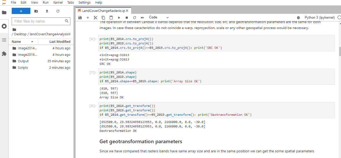
We can discuss how a approach for landcover change analysis using Rasterio
Sensing of some changes via airphotos can express among useful approaches for pre-location determination referencing geophysics land applications.Next,we can summary increased of capabilities about acquisition of airphotos discussing technologic advancements of actual times.So,a practicality thus expressing.Well,What are developments in terms of opensource capabilities about analysis chapter for thistype aims of airphotos?I share your attention with a landcover change analysis approach using rasterio such a example;


Datalink:
https://hatarilabs.com/ih-en/land-cover-change-analysis-with-python-and-rasterio-tutorial


Yorumlar
Yorum Gönder