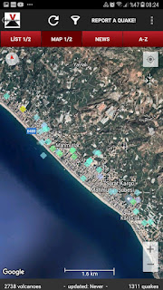
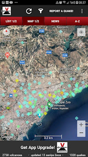
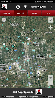
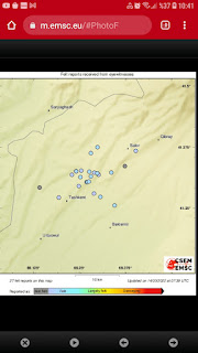
I continue via this link informations due to dbase matters
https://mybloginfrmtns.blogspot.com/2021/09/i-continue-to-sharing-on-this-link-due.html?m=1
Update 2/24:
Expressing 'important shaking reports' for Medellin* on a reference of magnitude-distance relations after a M5.5 env event for NWestern Barrancabermeja(distance >200 km!!!) ;
*:Capital City of Departimento Antioquia.A settlement region of Aburra Valley as geologic. And,second big city after Bogota(Main city of Colombia)
My first evaluations say reached to amazing dimensions of sediment thickness of Aburra Valley!!!So,effect of terrible ground magnifying
Also,I cite to important stru cond reflectory seismic waves of area summarying BellaVista(Colombian) region as frame✋
Update 2/25:
Other day,I observe again "extraordinary shaking reports" on magnitude-distance relation;
distance between event centre-settlement reports>250 km!!!So,As a comparison,a cond as dense sensing for a settlement on far SE of Ankara of a big seismic event at IzmitBay😮Really,amazing😐
Realities based on geologic of settlements
Kuala Lumpur: Malesia's Capital City.A settlement region of Klang Valley as geologic.
Malacca City:Malacca State's Capital at Maleysia.City is located on both sides of Molucca River as geologic.
Singapore:A island country and city state.Island is including similar type dreinage formations based on Singapore River.Similar to Rhodos Isl as dimension.
I cite to important stru conds reflectory seismic waves of Western Dumai and Eastern Buatan as frame✋
By the way,I present to source mechanism thesis against to requests of some geoenvironments;
https://emarekpanama.weebly.com/physical-features.html
I cite to important stru conds reflectory seismic waves of 'Warsobtugua Region' as frame✋
Update 3/13:
Subject selective shaking news on Magnitude-Distance relation for SWestern Anchorage;
Update 3/14:
There are selective shaking news on Magnitude-Distance relation for Hucend(Hokand as Anatolian Turkish pronunciation) Reservoir Region;
Update 3/15:
There are selective shaking news on Magnitude-Distance relation for SEastern Uruapan;
Update 3/17:
There are selective shaking news on Magnitude-Distance relation for DUBAI;
A geologic frame based on dense shaking phenomena;
Located at the head of Tokyo Bay.Tokyo Bay juts prominently into the Kanto Plain!The shore of Tokyo Bay consists of a diluvial plateau and is subject to rapid marine erosion!Sediments on the shore of the bay make for a smooth,continuous shoreline.
Tokyo Bay includes the Uraga Channel.By this definition the bay opens from an area N of the straight line from Cape Tsurugisaki on the east of Miura Peninsula to Cape Sunosaki on the W of the Boso Peninsula.This area covers about 1100 km^2.The area of TokyoBay combined with the Uraga Channel covers 1500 km^2.
The shoal between Cape Futtsu in Chiba Prefecture and Cape Honmaku in Yokohama is known as Nakanose,and has a depth of 20 m.N of this area the bay has a depth of 40 m and an uncomplicated underwater topography.Areas South of Nakanose are significantly deeper moving towards the Pacific Ocean.
Numerous rivers empty into Tokyo Bay,and all provide water for residential and industrial areas along the bay.The Tama and Sumida rivers empty into the bay at Tokyo.The Edo River empties into Tokyo Bay between Tokyo and Chiba Prefecture.The Obitsu and Yoro rivers empty into the Bay in Chiba Prefecture."Tokyo Bay includes about 249 km^2 of reclaimed land area in 2012"
I sign to important stru conds reflectory seismic waves for zonal morphology geography framing as Takahagi and Hitachi of IBARAKI
Update 3/19:
There are selective shaking news on Magnitude-Distance relation for ALGIERS;
Update 3/21:
There are selective shaking news on Magnitude-Distance relation for CEBU CITY;
Update 3/23:
There are selective shaking news on Magnitude-Distance relation for TAIPEI CITY;
There are selective shaking news on Magnitude-Distance relation for Tumaco;
There are selective shaking news on Magnitude-Distance relation for Quito;
Update 3/31:
There are selective shaking news on Magnitude-Distance relation for Asunsion;
Update 4/2:
There are selective shaking news on Magnitude-Distance relation for Cordoba;
The city is located in the plain of the Humid Pampa, to the east of the oriental cord of Córdoba Hills or Sierras Chicas, also known as the Sierras Cordobesas, which has an average height of 550 m. It spreads at the foot of the mount, on both banks of the River Suquía, and flows into the San Roque reservoir; from there, the Primero River goes east into the plains surrounding the city of Córdoba.
Once inside the city, the La Cañada stream meets the Rio Primero near the city centre area.
Update 4/8:
There are selective shaking news on Magnitude-Distance relation for Blantyre;
The most conspicuous and dominant physical features are the numerous hills found in all parts of the city. The main hills are the headwaters of several rivers and streams that originate and radiate from the city, forming a natural drainage system with nine distinct catchment areas: Likhubula, Lunzu, Mombezi and Khombwi, which drain the northern part of the city, and Mudi, Chisombezi, Limbe, Luchenza and Mwampanzi draining the middle and southern parts. Because of the hilly topography, these natural drainage channels are narrow and have steep sides and gradients.
The plateau and ridge comprises all the land that is suitable for urban development including extensive relatively flat land, the mountain piedmonts and plains, and long narrow watersheds and strips of land that separate the rivers and streams.
I sign to important stru conds reflectory seismic waves of snapshot as region;


Triggering matters related to ground stability chapter focused of various geoenvironment after selective shaking events effecting Colombia,Malay Peninsula and Panama Geographies...Thus,there are news for Malaysia Region;
YanıtlaSilhttps://www.youtube.com/watch?v=xwmG8XfF9jY