I share selective shaking devs via this link
I continue informations via reference link;
https://mybloginfrmtns.blogspot.com/2022/06/i-contuinue-to-informations-from.html?m=1
Update:
September 20
We observe selective felt reports for various far settlement of Mexico after M7.0 env event of Maruata region😐(Tepic,Puerto Vallarta,Guadalajara,Aguascalientes,Leon,Irapuato,Morelia,Celaya,SanLuisPotosi,Toluca,MexicoCity,Pachuca,Puebla,Zamara,Uruapan)
Most selective dscrptns among these settlements;
Update:
September 28
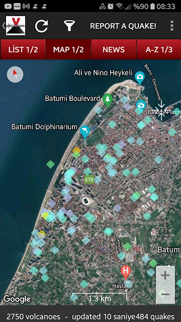
Expressing weird ground conds as geophysical for Batum on Magnitude-Distance relationship after Kars region event😐
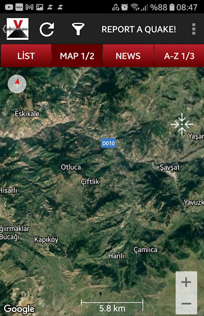
And,a source region description to needs of geoenvs with some evaluations;
Yes,morphology framing Şavşat-Otluca-Hisarlı-Kapıköy-Hanlı-Çamlıca as frame is signing to selective a point😐
Update 9/30:
I observed selective felt reports after M5.5 env of Myanmar...And,I have a decision on Magnitude-Distance relationship for two settlement;
Geologic Realities about Guwahati:
The Brahmaputra river flows to the north of the metropolis. The city is bordered on the south by the foothills of the Shillong plateau and to the east by the Amchang Wildlife Sanctuary. The Bharalu River, a tributary of the Brahmaputra, flows right through the heart of the city. To the south-west of the city lies Dipor Bil, a permanent freshwater lake with no prominent inflows apart from monsoon run-off from the hills that lie to the south of the lake. The lake drains into the Brahmaputra, 5 km (3.1 mi) to the north, and acts as a natural stormwater reservoir for the city.There are also multiple hills within the city limits.
Geologic Realities about Shillong:
Shillong is at 25.57 ° N 91.88 ° E. It lies on the Shillong Plateau, the only major uplifted structure in the northern Indian shield. The city lies in the centre of the plateau and is surrounded by hills, three of which are revered in Khasi tradition: Lum Sohpetbneng, Lum Diengiei, and Lum Shyllong.
Shillong is just 100 km (62 mi) from Guwahati, which can be accessed by road along NH 40, a journey of about 2 hours 30 minutes through lush green hills and the Umiam lake in between.
And,I share attention of some geoenvs two region description;
Update 11/9,2022:
I witnessed frequently during individual map analysis studies summaried selective a structure as ground conditions of Capitalcity of India😐As supplementary this condition,I share selective report regions on seismic event of 11/8;
Update 11/17,2022:
Note.I summary a settlement region shaped of Rio Grande floodplain as base.And next,El Paso is expressing "interesting border region" with Juarez City of Mexico.


Yorumlar
Yorum Gönder