A working about Useful for Analysis by Earth Inner Structure of Soho or Lasco Images
https://plus.google.com/u/0/109215510128907332215/posts/bmkqhXJ4gb5
Thus,I realised a calculation;
So,Mayotte and Hawaii that interested as applicability to Earth Inner Modelling on Latest Soho or Lasco Images(Where,shortly that you know Hawaii is having to beamtype effect.Next,Latest Soho or Lasco Images at 180 degree that thus yielding to good conclusions about condition of Mayotte region by similar type characteristics!!!)
Note:Mayotte that expressing as a mystery for seismologists.This solution technique that thus presenting to condition as quite clear for some question marks
Mayotte as SW on Patern is understanding.I considered that a working for Mayotte;

for Hawaii Region;
Note:
on Solar Data,Mayotte&Hawaii configuration that considered as more clear for calculation
A Brainstorm that about 3D issues
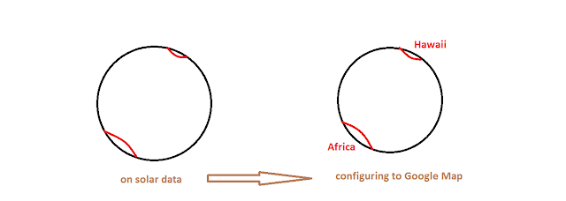
To Hawaii from Mayotte that you will evaluate which 180 different linear route is subject.Thus,where, we only analysing to methodology of a determination via considering to presentation as standart NS directed of World.So,Solar Data;
Because you know that only there are two possibilities(So,by one line condition from two point on which a third indicator between Africa and Hawaii you will evaluate that is not subject.Thus,a solution by standart configuration of Google Map as comparison with solar data on two point have considered)
So,as most possible,on 1/180 possibility...
Two scheme summary that 180 degree configuration as most powerful due to expressed causes
on Red circles,E region of Mayotte that interesting...Other interesting some locations that especially Seismologist;
_SW of Klimanjaro
_Lago Victoria
_Lake Kivu
_Kikwit
-Kirkwood Geologic Zone
-Madagaskar Cental Curve
Unfortunately,a point as fix as SE direction that with Google Earth can not evaluate...Thus,four orthogonal diameter(red) by our first determination and you will understand that other diameters(blue circles) on big centre(So,for evaluate to locations)
about orthongoal Red Circles;
I
Some interesting locations on I
II
III
Some interesting locations on III
IV
#And,Blue Circles
I

Interesing locations on I
II
Interesing locations on II
III

IV
Interesing locations on IV
V

Interesting locations on V
VI

Interesting locations on VI
VII

Interesting locations on VII
VIII

Interesting locations on VIII
analysing step to focal points on final determination;
Firstly,I decided radial boundaries by centre points for N and S wide angles,
- pink markers that centre points of purple circles on N wide angle possibilities
- iceblue markers that centre points of iceblue circles on S wide angle possibilities
Note:Iceblue and Purple Circle boundaries are important Geologic Locations
IP
IiB

IIP

IIiB
IIIP
IIIiB
IVP
IViB

total presentation as Hemisphere;
And,a 10000km analysis that
A 10000km by Lower-Centre-Upper points of Mayotte circle(with orthogonal that 4 point+1 point as centre)
Similarly,A 10000km for Hawaii circle(with orthogonal that 4 point)
TOTAL:9_10000km curve
Centre of Hawaii circle
Centre of Mayotte circle


Yorumlar
Yorum Gönder