Explanation after M4.0 env event_SW TURKEY
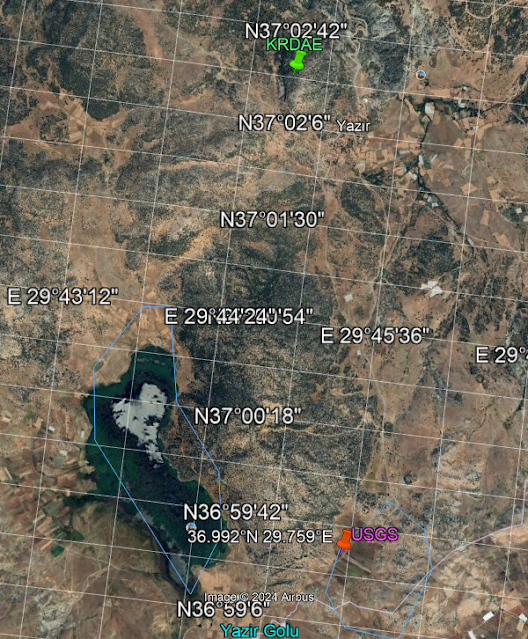
Firstly,I must say that USGS and KRDAE are descripting different locations;
 |
| distance ~5.25 km |
KRDAE Data say correlation to morphologic structure region;
USGS Data express karstic morphology land as correlated to waterbody field dbase;
Also,signing "a condition related to Karstic Depression of Earthquakes by USGS data" as a whole karstic characteristics of this lake with W position of Lake Yazır


Yorumlar
Yorum Gönder