Kayıtlar

Location Informations on Instant Solar Orthogonal Plane System

Resim
Note .Area summarying to possible impact structure as morphologic;   I share conclusions of an analysis about structure based on seismicity of region as add;                  USGS querying conclusions between 1900-2024(minimum magnitude for querying is 2.5) Understanding "selective low frequency condition" referencing querying frame for circle region(~5 event on USGS querying) 

Location Informations on Instant Solar Orthogonal Plane System

Resim
 

Mayon News

Resim
  A phreatic explosion took place at the volcano today. At 04:37 local time, the eruption spewed a white-to-grey ash column, consequently culminating in block-and-ash flows and hot rock falls. Copious emissions of ash rose to about 1,200 meters above the summit extending southwest. A colour of released tephra likely represents the lava dome material, partially destroyed by the vigorous explosion. Volcanologists find this eruption as Peleean-type, i.e. explosive events on growing lava domes. Seismic recordings detected the event lasting 249 seconds. The alert level for the volcano remains at Level 2. Source: Philippine Institute of Volcanology and Seismology volcano activity update 4 February 2024

Location Informations on Instant Solar Orthogonal Plane System

Resim
  Note .Area summarying to possible impact structure as morphologic;

Google Earth Circle Tool-example about principle of an orthogonal analysis based on selective geologic element

Resim
  Where,main chapter that carrying-out  "perfect determination" based on x and y axes of your focus geologic element😐After this step, very very easy via Google Earth Pro determining (lat1,lon1) and (lat2,lon2) points referencing x and y axes!In this field,I experienced various working type😐I recommend approach to users among "most applicable solutions" of geologic information concept👍 For presentation supplementary to explanation;

Merapi Developments

Resim
  A strong eruption occurred at the volcano yesterday afternoon. At around 12:54 local time, a large hot avalanche, known as pyroclastic flow, descended from the active lava dome at the summit crater. The extremely dangerous, fast-moving turbulent flow consists of a mixture of hot rock fragments of the lava dome, volcanic gasses and ambient air. It traveled through the Kali Boyong ravine on the southern flank and reached the usual distance of about several hundred meters from the summit. It also produced massive grey ash-abundant plumes, so-called phoenix clouds, separating from the block-and-ash flow. Pyroclastic flows are typically formed when the accumulated lava masses at the summit crater, known as the lava dome, become too large and suffer smaller or larger gravitational collapse, which then turn into fast and deadly avalanches as they destroy and burn everything in their path. The alert status remains at Level 3 since 5 November 2020. The public is being warned to stay at le...

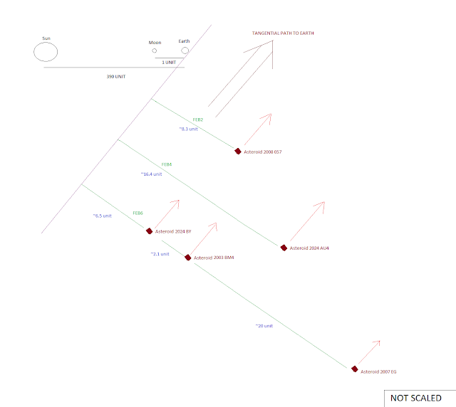
My explanations considering needs of some envs in light of actual developments

Resim
  I approbate informing via a schematic presentation to developments on neartime frame considering some information deficiencies about asteroid transitions; I hope to satisfying role some needs of short but clear informations